
Theme Tag Line

Welcome to the TIE program at IGARSS 2023. We invite you to explore with us the future of climate remote sensing and quantum sensing with experts from academia, industry and NASA. Come engage in thought provoking discussions on unconscious bias and the importance of diversity, equity and inclusivity in our workplaces. Take advantage of our workshops and pick up practical skills in python and resume building. Join us for all this and more!
“Introduction to Geospatial Raster and Vector Data with Python” is an open source curriculum that teaches researchers how to query, fetch, analyze, and visualize geospatial data with python. The lesson is taught as a live coding workshop using the interactive Jupyter notebook programming environment, on participants' own laptops. The instructor works with real world remote sensing datasets (Sentinel-2) and environmental data (agricultural and urban features in and near Amsterdam). Fundamental geospatial libraries are introduced and the learners are shown how they interoperate together to form a holistic GIS. This tutorial is relevant to the IGARSS community, as it highlights a method of accessing and analyzing geospatial imagery that 1) uses modern metadata standards (STAC) to make it easier to use the same code to query and fetch remote sensing datasets from a variety of providers 2) using python based geospatial libraries like xarray and geopandas allow for a more scalable workflow that can be adapted for large or small datasets. Increasingly, datasets are being made available in STAC metadata format, by both private cloud providers (Amazon AWS, Microsoft Azure Planetary Computer), and NASA (NASA CMR), and this lesson shows learners how to take advantage of this trend to more easily fetch and analyze their data.
Software requirements and setup:
https://carpentries-incubator.github.io/geospatial-python/setup.html
Hosted by Dr. Rashmi Shah, JPL and Professor Chris Ruf, University of Michigan
Panelists:
This event will start with a 10 minute presentation on the findings of a study sponsored by the Keck Institute of Space Studies (KISS, kiss.caltech.edu) on developing a resilient climate remote sensing framework. This will be followed by a 50 minute panel discussion with researchers including those involved in the KISS study.
Abstract:
Space-based Earth observations enable us to understand the wonder and complexity of the planet we live on. They provide society with situational awareness of local-to-global environmental conditions and support predictive guidance for near-term weather extremes. While these capabilities are indispensable to safeguarding life and property – as well as supporting trillions of dollars in economic and resource management decisions – there are needs and opportunities to greatly expand their utility and impact. Society’s growing reliance on environmental information supporting the connectivity and complexities of our food, water, transportation, shipping, energy, communications, and health sectors, along with the growing impacts of climate change on these sectors, suggest an increasing need for continuous monitoring, enhanced user access and data discoverability, and authoritative long-term data stewardship.
In 2022, there was a study sponsored by the Keck Institute of Space Studies (kiss.caltech.edu) to codify best practices, articulate successes, and identify challenges and opportunities in
the prioritization, acquisition, curation, and stewardship of sustained space-based environmental records. The goal of the study was to accelerate discussion and plans for a greater and more impactful U.S. contribution to the global satellite observing system that will support decision-making regarding climate change, environmental hazards, and national security.
In this context, “climate” includes observations that support climate science and process understanding, as well as monitoring for environmental situational awareness, climate services, adaptation measures, and mitigation assessments. This includes accounting for the context provided by the international Global Climate Observing System (GCOS) program and the Committee on Earth Observations from Space (CEOS), recent and anticipated developments in technology and access to space, and commercial data providers, and the formulation of concepts for future satellite system architectures to address missing observations in, and continuity of, the global climate observing system.
This panel will discuss the recommendations and findings that came out of the study with a focus on the rapidly evolving landscape of space-based Earth viewing architecture options and technology improvements with increasing opportunities and lower cost access to space.
This panel will discuss unconscious bias and its impact on individuals and society. Unconscious biases are deeply ingrained automatic views that influence our perceptions, judgments, and behaviours without our conscious awareness.
The main speaker, Dalma Novak, will emphasize the importance of understanding and addressing unconscious bias, as well as its effects on decision-making and inequality.
The panel consists of
This event will initiate a dialogue on unconscious bias and prompt individuals to reflect on their own biases and take action to combat them. The diverse backgrounds and experiences of the panelists offer attendees a unique opportunity to gain insights and perspectives on unconscious bias within the remote sensing field. These discussions inspire our community to examine biases and to work towards inclusive and equitable environments in both our personal and professional lives.
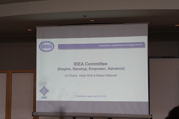
Join us as we foster an inclusive society! It is essential for supporting societal harmony, equality, and sustainable development. It entails appreciating and valuing the diversity of people and making sure that everyone has access to opportunities and assets that are equitable. It requires education as well as the development of empathy, respect, and understanding among people from all backgrounds. The Inspire, Develop, Empower, and Advance (IDEA) committee has organised three events, the third of which is this one. This session aims to achieve the following three goals:
This platform offers a great opportunity to communicate your ideas, reservations, and freeing thoughts. This interactive event will promote mutual understanding and motivation to build a community that offers equal opportunity to all.
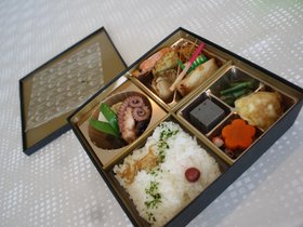
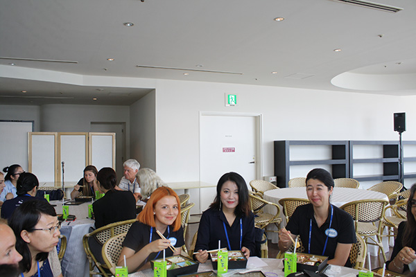
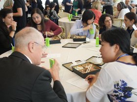
Everyone is welcome! Be sure to register for the Women in GRSS (WGRSS) Luncheon on Tuesday, July 18, 2023! The luncheon, organized by the Inspire, Develop, Empower, and Advance (IDEA) committee, provides a forum for men & women interested in supporting diversity to interact in an informal setting. The luncheon immediately follows the DE&I Unconscious Bias session, which we hope you can attend. After a short welcome and introductions, you’ll have the opportunity to discuss & network with other participants and the DE&I Unconscious Bias session speakers over lunch. The atmosphere is welcoming and you will surely leave the event and continue the conference feeling like you have new friends at your side. The lunch will include a boxed lunch and a free alcoholic drink ticket / soft drinks plus prizes so don’t miss out!
Hosted by: Dr. Upendra N. Singh, NASA Technical Fellow for Sensors and Instrumentation, NASA Langley Research Center
Quantum Sensing is an emerging sensing modality that uses quantum properties of matter and light---namely, quantum superposition, measurement, and entanglement---to achieve unprecedented measurement sensitivity and performance, including quantum-enhanced methodologies that outperform their classical counterparts. Typical quantum sensors exploit techniques such as quantized energy levels in atomic systems, matter waves, quantum entanglement, superposition of quantum states, quantum illumination methods, and manipulation of photons and atoms, in general. Guided by advancements in our ability to generate, manipulate, and control quantum systems, the emerging quantum sensing technologies promise unrivalled sensitivity, resolution, and precision, potentially leading to game-changing applications. Significant gains include technologies important for a range of NASA, Department of Defense, National Reconnaissance Organization, and United States Space Force missions such as timing, remote sensing, in situ measurements, metrology, interferometry, quantum communication, ranging, imaging, radar and lidar receivers, and gravity measurements. This Technology, Industry and Education (TIE) session will bring together a panel of experts from industry, academia, and government, to brainstorm with the IGARSS attendees on the potential of Quantum Sensing in the near and far terms. After some brief remarks by the panel members, questions from the moderator, the audience will engage with the panel members in an open question and answer session to explore the current state of the art in quantum sensing and the potential for revolutionary gains in the performance of various sensor types.
Panel Members:
There will be a Meet and Greet Session with IGARSS delegates and Quantum Sensing Industry folks, just after the conclusion of the TIE session (18 July, 17:30).
There are also two community-contributed sessions on July 18 on Quantum Technology for Remote Sensing, see below
TU2.R14: Quantum Technology for Remote Sensing I | Tue, 18 Jul, 10:15 - 11:30
TU3.R14: Quantum Technology for Remote Sensing II | Tue, 18 Jul, 13:00 - 14:15
L3 Harris
This session will discuss image preprocessing, best practices for working with multiple datasets, building and creating spectral libraries, working with indices, and automating hyperspectral processing using ENVI®. Attendees of this session will received a 90 day license of ENVI+IDL+ENVI Deep Learning Module and materials related to the presentation. Experience with hyperspectral data is helpful, but not required.
A well-crafted resume is essential for a successful job search, serving as a gateway to unlocking new career prospects and making a lasting impression on potential employers.
Join us for an engaging Resume Writing Workshop led by Jillian Kinsey, the owner and founder of Red Pen Wench, a renowned nationwide career services business. With a team of professional writers specializing in resume and cover letter writing, LinkedIn profile optimization, and interview coaching, Red Pen Wench has consistently been voted among the nation’s Best Resume Writing Services by Find My Profession. Drawing from her expertise as a Certified Professional Resume Writer (CPRW), Jillian will provide valuable insights into crafting resumes that effectively showcase your skills and achievements, helping you navigate the job search process with confidence.
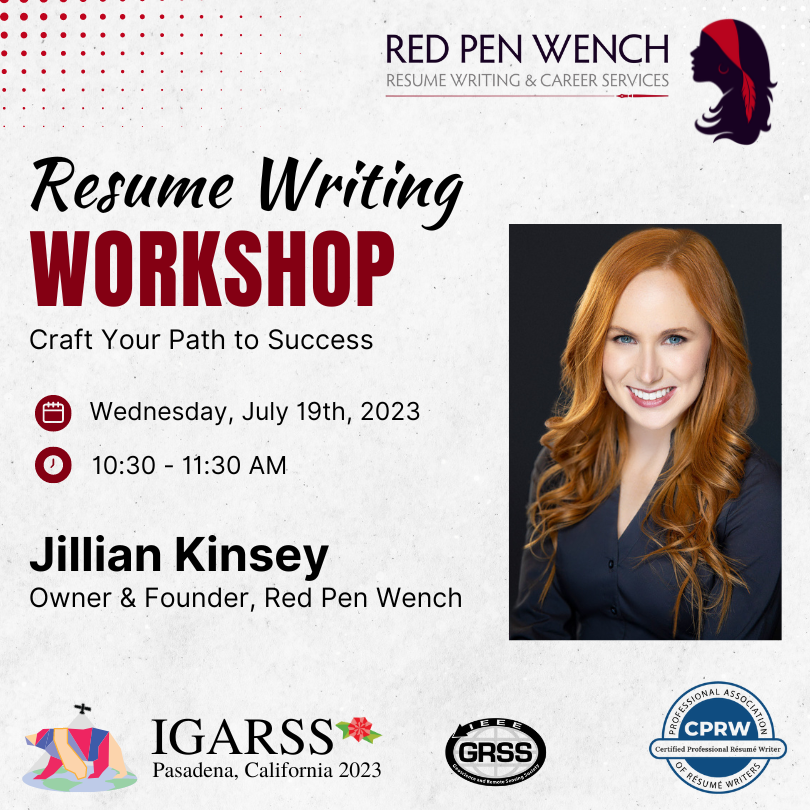
Would you like to receive personalized live feedback on your resume during the workshop? Send your resume to yp@grss-ieee.org by June 30. Jillian will be selecting 2 or 3 resumes to review during the session.
Don't miss this opportunity to learn valuable resume writing and job search strategies from a trusted expert in the field.
Jillian Kinsey, a Certified Professional Resume Writer (CPRW) and member of the Professional Association of Resume Writers and Career Coaches, founded Red Pen Wench in 2014 with the desire to assist clients on their academic and professional journeys and make the job search process a more rewarding one. She built a team of exceptional writers with a shared passion for working one-on-one with clients to elevate their career materials. With a genuine passion for crafting content that showcases each client’s unique skill set, achievements, and career journey, the Red Pen Wench team has written hundreds of resumes across a diverse range of industries for professionals around the world.
The main goal of this townhall is to provide an opportunity for the research community to engage with NASA’s ESTO personnel. This even is an opportunity for researchers to directly interact with program managers and fellow researchers and discuss all aspects of ESTO’s funding mechanism and expectations as well as share their own experiences.
This event will feature the following:
Hosted by Kevin Corbly, Corbly Communications
Starting a successful geospatial business takes more than just a good idea. This workshop will walk you through the key steps from concept to launch. You will hear from two executives as they describe their geospatial start-up journeys. Then a Venture Capital expert will discuss the many funding options available to get your business off the ground. Finally, you will learn about international Business Accelerator programs that can help propel your business from idea to reality. A moderated Q&A discussion with audience input will follow the presentations. You will leave this workshop understanding what it takes to start – and run – a geospatial business that succeeds long term in the competitive global marketplace.
Mo is the Founder and CEO of Wherobots.ai and computer science faculty member at Arizona State University. Dr. Sarwat is a recipient of the 2019 National Science Foundation CAREER award. His training and technical expertise lies in developing robust and scalable data and AI systems for spatial and spatiotemporal applications. The outcome of his work has been recognized by two best research paper awards. Mo is also the creator and architect of several software artifacts, which include Apache Sedona - a scalable system for processing big geospatial data that is being used by major tech companies (https://github.com/apache/sedona).
Company: Wherobots (Wherobots.ai)
Position: CEO
Twitter: @MoSarwat
LinkedIn: https://www.linkedin.com/in/mosarwat/
Dr. Daniela Moody is the Chief Technology Officer at Geosite. Previously, Daniela served as the VP of Artificial Intelligence at Arturo, and as the Chief Technology Officer at Ursa Space Systems (Ursa), focusing on analytic solutions to derive business intelligence from multimodal aerial and satellite data. Daniela also worked at Descartes Labs as technical project lead for broad area food security monitoring efforts. She was at Los Alamos National Laboratory for 9 years prior to joining Descartes Labs, working on remote sensing and machine learning applications in various research areas, including space systems, astronomy, on orbit RF and radar systems, and nuclear non-proliferation. She received her M.S and Ph.D. in Electrical Engineering from the University of Maryland, College Park with a focus in signal processing, computer vision, and machine learning. Daniela is a Senior IEEE member and has actively engaged in her Northern New Mexico Section, including Chairing the Signal Processing and Computer Science Chapters (2016-2019), and received an IEEE service award for her contributions as Chair. She is also an active member of the Forbes Technology Council and a National Academy of Engineers/Frontiers of Engineering Alumna.
Company: Geosite (https://www.geosite.io/)
Position: CTO
LinkedIn: https://www.linkedin.com/in/danielamoody/
Also attending in person from Touchdown VC: Beth Kearns beth@touchdownvc.com
Aubrey is an Associate at Touchdown Ventures. Touchdown partners with leading corporations to manage their venture capital programs. Aubrey has helped manage multiple funds across the Food & Agriculture sector on behalf of corporations including Scotts Miracle Gro, Kellogg, GROWMARK, and CHS. She currently devotes the majority of her focus to managing Cooperative Ventures, a venture capital fund founded in late 2021 as a joint venture between CHS and GROWMARK, two of the largest farmer-owned agricultural supply cooperatives in North America. The fund focuses on innovative solutions and emerging technologies that positively impact farming. Beyond her role as an investment professional, Aubrey also serves on the Advisory Board for Chappellet, a family-owned winery founded in 1967.
Company: Touchdown Ventures
Position: VC Associate
LinkedIn: https://www.linkedin.com/in/aubrey-chappellet-flagler-271958135/
For three decades, Kevin Corbley has been a key influencer in the worldwide geospatial profession. He is president of Corbley Communications, a Colorado firm that provides strategic communications, marketing content creation, and business development services. He earned a Bachelor of Science Degree in Geology from the University of Notre Dame before serving as a Capitol Hill journalist in Washington, D.C., covering the international energy business. He later managed the public affairs office for the Earth Observation Satellite Co. (EOSAT), which operated the U.S. Landsat satellites. Since starting his firm in 1993, Kevin provided start-up support to Space Imaging, DigitalGlobe, GeoEye, Radarsat, and RapidEye. He has served organizations in every sector of the geospatial industry including software developers, hardware vendors, and surveying/mapping companies. In his personal time, Kevin engages in entrepreneurship education and development programs.
Company: Corbley Communications (https://corbleycommunications.com/)
Position: Owner
LinkedIn: https://www.linkedin.com/in/kevin-p-corbley/
Organized by Jacqueline Le Moigne/NASA, Claudia Vitolo/ESA and Simon Baillarin/CNES
“Destination Earth (DestinE) and ESA Digital Twins of the Earth (DTE)”
“AIST Earth System Digital Twins (ESDT)”
“DT for the Alps and the DT Hydrology elements for the DT Alps demonstrator”
“ESDT Science Use Cases”
“A Federated NASA/CNES Earth System Digital Twin for Flood Prediction and Analysis”
“Community Building”
How scientists and industry can get involved (e.g., upcoming events, funding opportunities, explore the need for dedicated community tools, etc)
ESA and NASA have both started programs to design and develop Digital Twins of the Earth and/or Earth systems. Organized around interconnected, multi-domain, high-scale modeling capabilities, the three major components of an Earth System Digital Twin are a continuously updated Digital Replica of the Earth System of interest, dynamic Forecasting models, and Impact Assessment capabilities. Earth System Digital Twins integrate diverse Earth and human activity models, continuous observations, and information system capabilities to provide unified, comprehensive representations and predictions that can be utilized for monitoring the health of the Planet, as well as for developing actionable information to support decision making. More generally, Digital Twins will help researchers better understand the fundamental Earth systems that impact everything from wildfires to climate change.
This Townhall will first provide a short description of ESA’s and NASA’s current efforts in Digital Twins:
NASA and ESA are also currently defining science use cases that will be presented during the townhall; those and a few three-minute discussions of current projects will serve as a starting point to engage a dialogue about Digital Twins of the Earth with the IGARSS community.
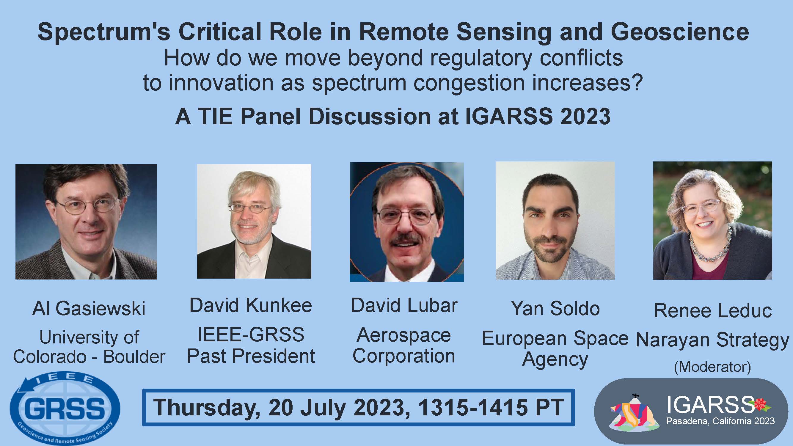
The use of radio frequency spectrum by diverse, emerging technologies (especially wireless telephony and internet of things (IoT)) has grown significantly in the past few decades. As spectrum allocations become more congested, the disputes between divergent users of radio frequency spectrum have become more intense. Regulatory conflicts at the national and international level have grown with the geoscience and remote sensing communities particularly involved and impacted, ranging from disputes about passive microwave observations for numerical weather prediction to allocations for global navigation satellite systems (GNSS). Much has been said by regulators and policymakers about the need for spectrum sharing, but research and innovation around such sharing has been limited. Such innovation also requires considerable coordination and cooperation across sectors and fields – from engineers and scientists to regulators and policymakers. This topic is particularly timely as the world approaches the triennial World Radiocommunication Conference (WRC-23) in Dubai in November 2023 where many agenda items will address spectrum challenges faced by the geoscience and remote sensing communities.
This session will convene a panel of diverse experts in spectrum engineering, geoscience applications and regulatory policy for a spirited moderated discussion of these complex issues. The session will explore the trade offs between spectrum sharing and protection of key remote sensing bands, and the required innovation to make sharing possible, weighing the perspectives of government, academic and private sector participants, while encouraging audience engagement in the dialogue. This topic is particularly important for the geoscience and remote sensing community at this time because the threats of harmful interference to the technologies we rely on is growing. In addition, new developments in remote sensing for geoscience related applications will potentially need more spectrum allocation, not less. Raising awareness of these challenges across the geoscience and remote sensing communities is particularly important as we will need to be increasingly engaged in regulatory process to communicate the value of our uses of radio frequency spectrum.
The success of scientists depends upon their ability to obtain funding. One of the largest challenges is to create strong proposals. Using Research Opportunities in Space and Earth Sciences (ROSES) from NASA as a template, this talk will focus on teaching the audience key points to communicating science through successful proposal writing. Attendees will hear about the proposal writing, reviewing, and selection process for federally funded research. How to understand one’s values and maintain those throughout this process will also be focused on. A discussion of writing proposals and storytelling will also occur. This talk will be a Tips and Tricks version of the larger workshops Dr. Richey does for NASA’s Science Mission Directorate (SMD).
Dr. Christina R. Richey is the Program Manager for Research and Technology Development in the Office of Research & Development at the Jet Propulsion Laboratory. They also provide guidance on the proposal process for divisions, and trains researchers within the community on best practices for proposal submission and review. Dr. Richey is also a consultant for the Europa Clipper Mission, and an affiliate team member of the Office for Inclusion.
In addition to their scientific activities, Dr. Richey has held several leadership positions and has actively engaged in education and public outreach opportunities. Christina is an accomplished leader and award winner in their field in dealing with anti-harassment policies and procedures and has been cited by major news agencies for their efforts within the community to create safe, inclusive environments. Christina has been awarded a Special Service Award at NASA HQ (2014) for their work within the Planetary Science community, as well as a NASA Group Achievement Award in 2020. Dr. Richey was honored with the AAS DPS Meritorious Career Service Award, the Harold Masursky Award in 2015. Dr. Richey was designated a Legacy Fellow by the American Astronomical Society (AAS) in 2019.
Hosted by Aline D. McNaull, IEEE-USA
With Congress looking at reauthorizing various space agencies, IEEE-USA looks forward to having our members weigh in on these discussions. This policy panel will hopefully lead to many policy discussions with our members.
Remote sensing policy has implications for many sectors of the economy, from environmental monitoring to defense applications. The US government and commercial companies provide remote sensing data and services to policy makers. IEEE-USA is focused on a few aspects of remote sensing policy. What are the challenges relating to data management? How can we support artificial intelligence-based analysis of remote sensing data? What are the current needs of the commercial remote sensing sector? During this panel discussion, we will hear from companies about commercial remote sensing policy. They will describe the current state of collaborations with the US government and where challenges exist. We will hear from a variety of companies, many of whom were involved in discussing policy changes in prior administrations.